Plenary Speakers
 |
Peter Batty is conference chair. He is VP of geospatial technology at Ubisense. He has worked in the geospatial industry for 20 years and has served as CTO for two leading companies in the industry (and two of the world's top 200 software companies), Intergraph and Smallworld (now part of GE Energy). He was a founder and CTO of Ten Sails, who provided early stage funding to and later merged with Ubisense. He serves on the Advisory Board of geoIQ. Peter will kick off the opening session with a welcome to the conference and will discuss his perspectives on open source and how the ex-CTO of two of the largest closed source geospatial companies has come to be chairing FOSS4G! |
 |
Arnulf Christl is a founding and Charter Member of OSGeo, serves on the Board of Directors and is current president of OSGeo. He is honored to have been elected to the list of OSGeo Spanish Charter Members. He contributes to the Incubation Committee, SAC and the Conference Committee. Arnulf will talk in the opening session on "The State of OSGeo" and will participate in the panel "Open x 4" on Friday. |
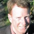 |
Paul Ramsey is a Geospatial Architect at OpenGeo. He has been working with geospatial software for over ten years, as programmer and consultant. He founded the PostGIS spatial database project in 2001, and is currently an active developer and member of the project steering committee. In 2008, Paul received the Sol Katz Award for achievement in open source geospatial software. Paul speaks and teaches regularly at conferences around the world. Paul will be talking in the opening session on "Why do you do that? An exploration of open source business models." |
 |
Steve Coast is the founder of OpenStreetMap and CloudMade. In 2010 he left CloudMade to become Principal Architect at Microsoft's Bing Mobile. Steve will talk on Thursday about "OpenStreetMap: the mappers map" and will participate in the "Open x 4" panel on Friday. |
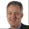 |
Peter Ter Haar is Director of Products at Ordnance Survey, the UK National Mapping Agency. Peter is responsible for all aspects of product management, including product marketing, licensing, research, engineering, cartography and supply. Peter has worked in both the public and private sectors in GIS, location-based services and mobile technology. His previous roles include Head of GIS at the City of Amsterdam, and senior product and technical management roles at Geodan, Autodesk and Intergraph. Peter has been the lead director at Ordnance Survey for the development of OS OpenData and is responsible for the open source activities of Ordnance Survey, the OS OpenSpace portal and the standards activities with the Open Geospatial Consortium. Peter will speak on Thursday on "Open Season: Open Standards, Open Source and Open Data in Ordnance Survey". |
 |
Michael Byrne is Geographic Information Officer for the FCC (Federal Communications Commission). Michael will speak on Thursday on "A New Way of Open Data". |
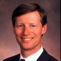 |
Dr. Carl Reed is the Chief Technology Officer at the Open Geospatial Consortium (OGC). Before joining the OGC, he was vice president of geospatial marketing at Intergraph Corporation, and before that he had served as chief technology officer for Genasys II worldwide. Carl will participate in Friday's panel on "Open x 4". |
 |
Matt Ball is a co-founder of Vector1 Media. Prior to that, he was editor-in-chief of GeoWorld magazine for seven years, and managed all aspects of the GeoTec Event, Canada's largest geospatial industry event. Before working in the geospatial industry press, he was in charge of marketing and exhibit sales for the Geological Society of America’s annual meeting. Matt writes and edits V1 Magazine and Asian Surveying and Mapping, blogs at Spatial Sustain, and can be found on Twitter @spatialsustain.
Matt will moderate Friday's panel on "Open x 4".
|
 |
Jeff McKenna has his own company, Gateway Geomatics, focused on open source geospatial software. Jeff is on the board of OSGeo, is a MapServer Project Steering Committee member, and is chair of the OSGeo conference committee. Jeff will be leading the Web Mapping Performance Shootout in the conference closing session. |
 |
Schuyler Erle is a long-time Open Source software developer and activist, and a founding member of OSGeo Foundation. Schuyler was a co-author of "Mapping Hacks: Tips and Tricks for Digital Cartography", one of the first books on the subject of digital cartography and GIS aimed at the mass market. Schuyler co-founded the OpenLayers and TileCache projects, two widely used components in the OSGeo software stack. Schuyler will close proceedings on Wednesday with a talk entitled "Pivoting to Monetize Mobile Hyperlocal Social Gamification by Going Viral" |
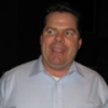 |
Brian Timoney founded The Timoney Group in 2005 to focus on web-based delivery of visual information, after a decade of applying his GIS skills in areas such as land development, environmental remediation, defense, and energy, . Active in promoting the possibilities of web mapping platforms in particular, Brian has presented at conferences such as Location Intelligence, Where 2.0, GIS In The Rockies, and ESRI PUG. Brian will enlighten us at the close of proceedings on Thursday. |


